Why the World’s Peatlands are Key to Stopping Climate Change

Montane Peatland, Polblue Swamp, Barrington Tops National Park by Doug Beckers (CC BY-SA 2.0).

By Gustaf Hugelius, Senior Lecturer, Physical Geography, Stockholm University, World Economic Forum published in collaboration with The Conversation (Public License).

  • Peatlands count for just a few percent of the world’s land, but crucially store almost one-quarter of soil carbon.
  • They play a vital role in regulating the climate, but they’re under threat.
  • A new study from Stockholm University has shown that rising temperatures will mean peatlands will soon start emitting more carbon than they store.
  • Researchers found that by limiting global warming, the worst could be avoided.

Peatlands cover just a few percent of the global land area but they store almost one-quarter of all soil carbon and so play a crucial role in regulating the climate. My colleagues and I have just produced the most accurate map yet of the world’s peatlands – their depth, and how much greenhouse gas they have stored. We found that global warming will soon mean that these peatlands start emitting more carbon than they store.

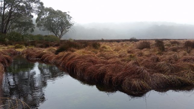
Peatlands form in areas where waterlogged conditions slow down the decomposition of plant material and peat accumulates. This accumulation of carbon-rich plant remains has been especially strong in northern tundra and taiga areas where they have helped cool the global climate for more than 10,000 years. Now, large areas of perennially frozen (permafrost) peatlands are thawing, causing them to rapidly release the freeze-locked carbon back into the atmosphere as carbon dioxide and methane.

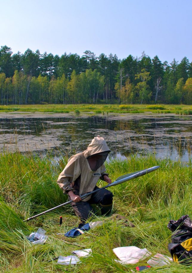
Geoscientists have studied peatlands for a long time. They’ve looked at why some areas have peat but others don’t and they’ve looked at how peatlands work as natural archives through which we can reconstruct what the climate and vegetation was like in the past (or even what human life was life: many well-preserved ancient humans have been found in peat bogs).

Scientists have also long recognised that peatlands are important parts of the global carbon cycle and the climate. When plants grow they absorb CO₂ from the atmosphere and as this material accumulates in the peat, there is less carbon in the atmosphere and therefore the climate will cool in the long-term.

With all this knowledge about how important northern peatlands are, it is perhaps surprising to learn that, until recently, there was no comprehensive map of their depth and how much carbon they store. That is why I led an international group of researchers who put together such a map, which we can use to estimate how the peatlands will respond to global warming. Our work is now published in the journal PNAS.

Peatland data and properties north of 23°N latitude. (A) Estimated areal coverage (in percentage) of peatlands based on the national soil inventory maps and SoilGrids250m. (B) Estimated areal coverage (in percentage) of permafrost in mapped peatlands based on the national soil inventory maps and SoilGrids250m, including a maximum threshold for permafrost at MAAT +1 °C (use the same legend as in A). (C) Spatial distribution of peat core sites with peat depth data (n = 7,111) and peat organic C storage (n = 782) over a map of biome distributions (biomes adapted from ref. 32). Sites with peat N stock data (n = 105) are not shown in the map (see Dataset S6), but are predominantly located in boreal forest and tundra biomes. (D) Sites with peat organic C storage data, with the size of site symbols proportional to measured peat organic C storage, over a map of permafrost zonation (33). (E) Estimated total peatland C storage and (F) permafrost peatland C storage.
Peatland data and properties north of 23°N latitude. (A) Estimated areal coverage (in percentage) of peatlands based on the national soil inventory maps and SoilGrids250m. (B) Estimated areal coverage (in percentage) of permafrost in mapped peatlands based on the national soil inventory maps and SoilGrids250m, including a maximum threshold for permafrost at MAAT +1 °C (use the same legend as in A). (C) Spatial distribution of peat core sites with peat depth data (n = 7,111) and peat organic C storage (n = 782) over a map of biome distributions (biomes adapted from ref. 32). Sites with peat N stock data (n = 105) are not shown in the map (see Dataset S6), but are predominantly located in boreal forest and tundra biomes. (D) Sites with peat organic C storage data, with the size of site symbols proportional to measured peat organic C storage, over a map of permafrost zonation (33). (E) Estimated total peatland C storage and (F) permafrost peatland C storage. Source: Gustaf Hugelius, et al., PNAS (CC BY 4.0).

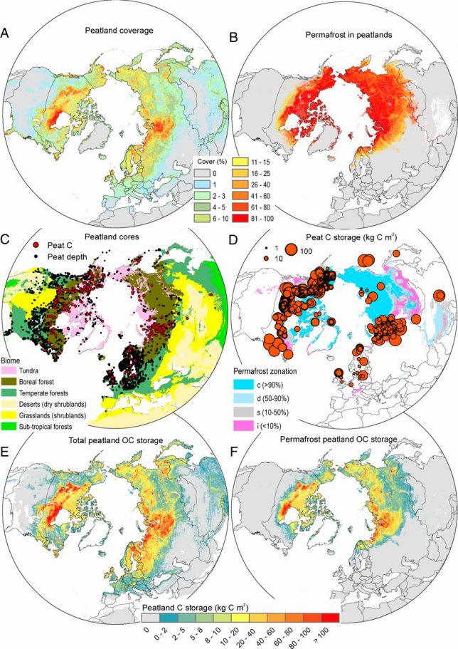
Peatlands are surprisingly difficult to map as their growth is connected to many different local factors, such as how water drains in the landscape. This meant we had to gather more than 7,000 field observations and use new statistical models based on machine learning to create the maps.

We found that peatlands cover approximately 3.7 million square kilometres. If it were a country, “Peatland” would be slightly larger than India. These peatlands also store approximately 415 gigatons (billion tons) of carbon – as much as is stored in all the world’s forests and trees together.

Almost half of this northern peatland carbon is presently in permafrost, ground that is frozen all year round. But, as the world warms and permafrost thaws, it causes peatlands to collapse and completely changes how they relate to greenhouse gases. Areas that once cooled the atmosphere by storing carbon would instead release more of both CO₂ and methane than they stored. We found that the thaw projected from future global warming will cause releases of greenhouse gas that overshadow and reverse the carbon dioxide sink of all northern peatlands for several hundred years. The exact timing of this switch is still highly uncertain, but it is likely to happen in the later half of this century.

There are regions of very extensive permafrost peatlands in Western Siberia and around Hudson Bay in Canada. These unique environments and ecosystems will be fundamentally changed as the permafrost thaws, and their characteristic mix of frozen peat mounds and small lakes will be replaced by extensive areas of wet fens.

Sampling peatland in Siberia. Gustaf Hugelius, Author provided.

These changes will cause more CO₂ and methane to be released into the atmosphere as the previously frozen peat becomes available for microbes that degrade it. The thaw will also lead to large losses of peat into rivers and streams, which will influence both the food chains and biochemistry of inland waters and the Arctic Ocean.

These new finding further reinforce how urgent it is to rapidly reduce our emissions, as the only way to stop permafrost thaw is to limit global warming. There are no geoengineering solutions that can be deployed in these vast and remote areas. Our results clearly show that more limited global warming of 1.5℃-2℃ would be much less damaging than our current trajectories of 3℃-4℃ degrees or above.

For a Flooded Midwest, Climate Forecasts Offer Little Comfort

By Shuang-Ye Wu, University of Dayton

File 20190328 139364 181r9hv.jpg?ixlib=rb 1.1
Historic flooding in the Midwest, including this farm in Nebraska, has caused widespread damage. DroneBase via AP

Flooding in the Midwest, triggered by an intense “bomb cyclone,” has devastated parts of the region, which has been plagued by flood events in recent decades.

Floods are triggered by extreme rainfall events, often combined with ground conditions, such as saturated or frozen ground, that make it harder for water to percolate down into soil, which increases runoff.

Global warming has the potential to intensify the Earth’s water cycle, which will alter the quantity, frequency, intensity and duration of rain and snowfall. As my research and work by others has shown, all of these changes raise the risk of floods for Midwest states.

A Wetter Midwest

There is strong consensus among scientists that climate change will make many parts of the world wetter. This happens because higher temperatures increase the rate at which moisture evaporates from Earth’s surface, and warmer air holds more moisture than cool air. For every 1 degree Celsius of warming, the moisture-holding capacity of the atmosphere increases by about 7 percent, based on well-established laws of physics.

As the air becomes moister, we can expect more precipitation – but the increase is not uniform. Assuming that wind patterns don’t change significantly, more moisture will be transported into some regions under the influence of storm tracks. This means that storm-affected areas are likely to experience larger-than-average increases in precipitation and flood risks, while areas located away from storm tracks are likely to have less precipitation and greater risk of drought.

The U.S. Midwest is located in a convergence zone where prevailing winds blowing from the east and west meet. The polar jet stream blows from west to east along the boundary between warm and cold air and regularly brings in storms, particularly in cold seasons.

Using data from the U.S. Historical Climatology Network, I have shown that from 1951 to 2013, mean precipitation for the United States increased by 1.6 percent per decade. In the Midwest, however, it rose by about 2.1 percent per decade, and winter precipitation increased by 3.7 percent per decade. About half of this growth was caused by more frequent storms, and the other half can be attributed to an increase in storms’ intensity.

I have also used high-resolution regional climate models to simulate future climate change in the Midwest for the period 2040-2070 compared to 1970-2000. In this study I found that mean precipitation across the region is likely to increase by 8 percent by mid-century, and winter precipitation is likely to increase by as much as 12 percent. The northern part of the region could see an even larger increase, likely due to greater evaporation from the Great Lakes resulting from higher temperatures and less ice cover in winter as the region warms.

Stormier Weather

With more moisture in the atmosphere, storm systems are likely to produce heavier rainfall events. Enhanced moisture in the atmosphere also increases latent heat – warmth released by water vapor as it condenses into liquid drops in the air. This heat provides more energy to increase the intensity of storms.

More intense precipitation events are predicted to happen in Midwest states. Shuang-Ye Wu University of Dayton, North American Regional Climate Change Assessment Program, CC BY NC 4.0

These factors mean that climate change is likely to cause a disproportionate increase in heavy precipitation events in the Midwest, a trend that is already apparent when looking at historic climate data. From 1951 through 2013, my study found that light and moderate precipitation across the Midwest increased by about 1 percent per decade, while heavy precipitation increased by 4.4 percent per decade.

Average precipitation for the region is projected to increase by about 8 percent by mid-century, but heavy storms – those of a scale only likely to occur once in 25 years – are projected to increase by 20 percent.

More Frequent Flooding

All of these changes will significantly alter flood hydrology. A 2015 study that examined discharge data from 774 U.S. Geological Survey stream gauge stations across the Midwest from 1962 through 2011 found that 34 percent of the stations showed significant increases in the frequency of flood events. The most pronounced increase occurred in springtime for floods associated with snowmelt, rain falling on frozen ground and rain-on-snow events. In addition to increasing precipitation, this analysis showed that earlier snow melting and changes in the rain-to-snow ratio caused by higher temperatures are also driving the strong increase in Midwest spring flooding.

Another study projected shifts in flooding due to climate change and calculated how frequently an average 20th-century 100-year flood – that is, large enough to have just a 1 percent chance of occurring in any given year, or once in a century – is likely to recur in the 21st century. For most of the Midwest, the authors estimated that the probability of such floods was likely to double in the 21st century, so that what was once a 100-year flood can be expected to occur on average every 50 years.

A third study, published in 2016, examined how climate change could alter streamflow in the Northeast and Midwest. The magnitude and timing of streamflow can affect water supplies and quality, infrastructure systems and aquatic life. This study found that over this century, average 100-year three-day peak flow levels were likely to increase by 10 to 20 percent for the Midwest region.

The Conversation

Meanwhile, people in Nebraska, Iowa, Wisconsin, Minnesota and South Dakota affected by the most recent storm are assessing the damage. NOAA earlier this month forecast that the historic floods will be followed by more rain and flooding this spring. Current flood waters are expected to remain for months.

By Shuang-Ye Wu, Associate Professor of Geology, University of Dayton

This article is republished from The Conversation under a Creative Commons license. Read the original article.